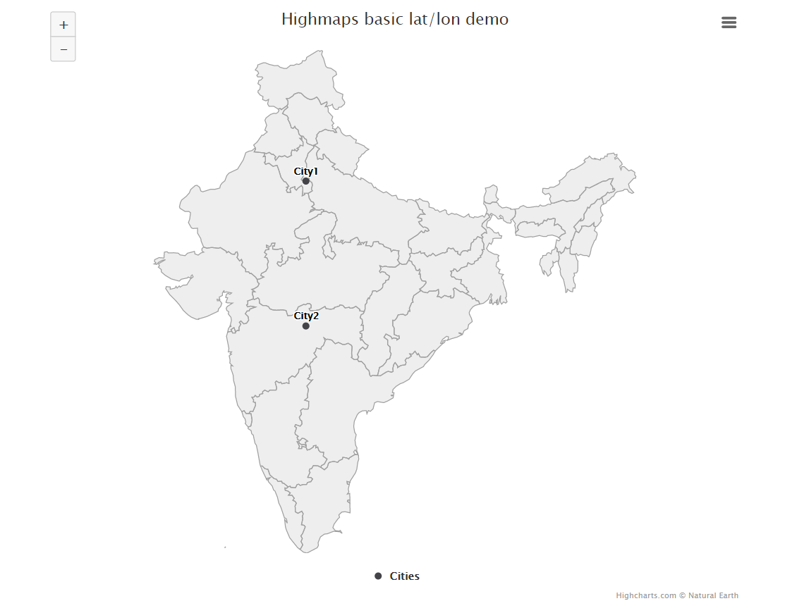
Creating Interactive Maps using HighCharts 21 Jun 2019
HighCharts
Highcharts is an awesome plotting library that helps in creating dynamic HTML charts, with less effort compared to D3.JS
The following are the steps to be followed for a simple implementation of plotting certain coordinates on a map
Creating the HTML File
The HTML file that we create will have the following components
HTML
<script src="https://cdnjs.cloudflare.com/ajax/libs/proj4js/2.3.6/proj4.js"></script>
<script src="https://code.highcharts.com/maps/highmaps.js"></script>
<script src="https://code.highcharts.com/maps/modules/exporting.js"></script>
<script src="https://code.highcharts.com/maps/modules/offline-exporting.js"></script>
<script src="https://code.highcharts.com/mapdata/countries/gb/gb-all.js"></script>
<script src="https://code.highcharts.com/mapdata/countries/in/in-all.js"></script>
<input type="file" id="myFile" multiple size="50" onchange="myFunction()">

<div id="container"></div>
STYLE/CSS
<style>
#container {
    height: 680px;
    min-width: 310px;
    max-width: 800px;
    margin: 0 auto;
}
.loading {
    margin-top: 10em;
    text-align: center;
    color: gray;
}
</style>
JAVASCRIPT
<script type="text/javascript">
// Upload the file

function myFunction(){
  var x = document.getElementById("myFile");
  var txt = "";
  if ('files' in x) {
    if (x.files.length == 0) {
      txt = "Select one or more files.";
    } else {
      for (var i = 0; i < x.files.length; i++) {
        txt += "<br><strong>" + (i+1) + ". file</strong><br>";
        var file = x.files[i];
        if ('name' in file) {
          txt += "name: " + file.name + "<br>";
        }
        if ('size' in file) {
          txt += "size: " + file.size + " bytes <br>";
        }
      }
    }
  }
  else {
    if (x.value == "") {
      txt += "Select one or more files.";
    } else {
      txt += "The files property is not supported by your browser!";
      txt  += "<br>The path of the selected file: " + x.value; // If the browser does not support the files property, it will return the path of the selected file instead.
    }
  }
  document.getElementById("demo").innerHTML = txt;
}

// Initiate the chart
Highcharts.mapChart('container', {

    chart: {
        map: 'countries/in/in-all'
    },

    title: {
        text: 'Highmaps basic lat/lon demo'
    },

    mapNavigation: {
        enabled: true
    },

    tooltip: {
        headerFormat: '',
        pointFormat: '<b>{point.name}</b><br>Lat: {point.lat}, Lon: {point.lon}'
    },

    series: [{
        // Use the gb-all map with no data as a basemap
        name: 'Basemap',
        borderColor: '#A0A0A0',
        nullColor: 'rgba(200, 200, 200, 0.3)',
        showInLegend: false
    }, {
        name: 'Separators',
        type: 'mapline',
        nullColor: '#707070',
        showInLegend: false,
        enableMouseTracking: false
    }, {
        // Specify points using lat/lon
        type: 'mappoint',
        name: 'Cities',
        color: Highcharts.getOptions().colors[1],
		data:[{'name': 'KO5490_1KM', 'lat': 28.477778000000004, 'lon': 77.129722},
 {'name': 'City1', 'lat': 28.5375, 'lon': 77.271694},
 {'name': 'City2', 'lat': 28.910079999999997, 'lon': 77.10876}]
     }]
});
Combine all the above 3 in order into a single HTML File

Important Configurations
Map
In the line
chart: {
        map: 'countries/in/in-all'
    },
We are mentioning the region in/in-all which means India. The list of all such regions is present here http://code.highcharts.com/mapdata/?_ga=2.240186051.15578447.1561097806-1754947431.1560948026
#### Tooltip In the following code
 tooltip: {
        headerFormat: '',
        pointFormat: '<b>{point.name}</b><br>Lat: {point.lat}, Lon: {point.lon}'
    },
We are using three variables from the list of Dicts lat lon and name. You can add as many as you want here